3D mapping system
Sku: HTI021
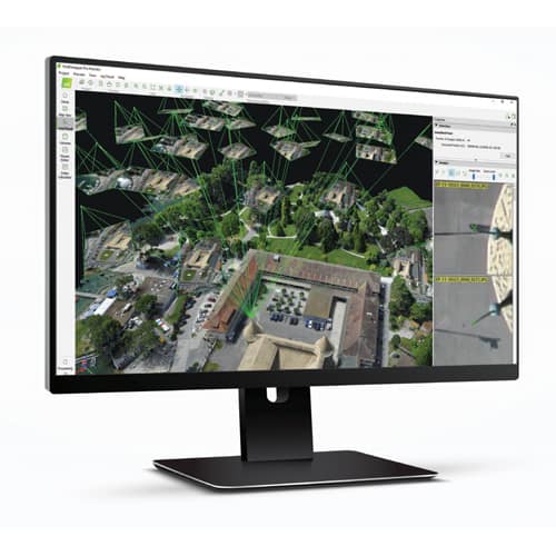
Short description: Pix4Dmapper automatically converts images taken by drone, by hand, or by plane and delivers highly precise, georeferenced 2D maps and 3D models. They’re customizable, timely, and complement a wide range of applications and software.
Product information
This post is also available in: Tiếng Việt (Vietnamese)
Pix4Dmapper automatically converts images taken by drone, by hand, or by plane and delivers highly precise, georeferenced 2D maps and 3D models. They’re customizable, timely, and complement a wide range of applications and software.
FEATURES:
- Capture your images with any camera or drone, process them locally or on the cloud, and selectively share any part of the project.
- A broad variety of tools to power applications in multiple industries, from surveying & mapping, construction, agriculture, mining & aggregates, public safety, oil & gas, power & utilities, to education & research.
- Use the software in your language. Pix4Dmapper is available on desktop in English, Japanese, German, Spanish, French, Chinese, Italian, Russian or Korean.
- Count on our personal technical support, expert user community, knowledge base and training programs to help you keep learning and overcome any issues.
- Sub-centimeter resolution from lightweight and compact cameras to largeframe metric cameras.
- Even for projects without geolocations by assigning linear scales.
- Get the results you require. Customize your projects by defining areas of interest, changing processing options or adding ground control points.
- High-speed processing using GPUs and multithread CPUs. Let the software handle all the calibration, image processing, and object classification.


